GeoAI for Agriculture and Planning

Introduction

Artificial Intelligence (AI) is reshaping industries worldwide—and agriculture is no exception.
At the SDG Foundation, we integrate GeoAI (Geospatial Artificial Intelligence)
with Machine Learning (ML) and Deep Learning (DL) to transform agriculture
and rural planning. By combining geospatial data with AI, we create innovative solutions that empower
farmers, policymakers, and communities to build climate-smart and sustainable futures.

Applications of GeoAI

  • Crop Classification: Rapidly identifying crop types across vast regions using satellite imagery
    and AI-based classification techniques.
  • Yield Prediction: Forecasting production levels with high accuracy to help farmers, markets,
    and governments plan better.
  • Sustainable Planning: Supporting urban development, water resource management, and
    climate-adaptive rural strategies with AI-driven geospatial insights.
  • Pest and Disease Detection: Monitoring vegetation health through AI models to prevent
    outbreaks and reduce crop losses.
  • Climate Adaptation: Using predictive analytics to recommend drought-resistant crops,
    optimize irrigation, and build resilience.

Why It Matters

Traditional methods of agricultural planning and environmental monitoring often rely on delayed,
manual surveys that cannot keep pace with today’s rapidly changing climate conditions.
GeoAI changes this by delivering real-time, data-backed intelligence.
This ensures smarter decision-making at every level:

  • For Farmers: Better crop management, efficient use of resources, and
    improved productivity.
  • For Governments: Stronger policy tools for food security, climate resilience,
    and rural development programs.
  • For Communities: Increased preparedness against climate risks and stronger
    livelihood opportunities.

Future of GeoAI in India

India’s agricultural landscape is vast and diverse, making it an ideal ground for
GeoAI applications. As the country moves towards Viksit Bharat @2047,
GeoAI will play a vital role in:

  • Smart Agriculture: Precision farming, automated irrigation, and predictive
    analytics for higher efficiency and lower costs.
  • Urban Planning: AI-powered geospatial data for sustainable cities, transport
    planning, and smart infrastructure development.
  • Water Management: Intelligent mapping of groundwater and river basins to
    ensure equitable distribution of water resources.
  • Climate Resilience: Data-driven adaptation strategies to protect vulnerable
    regions from droughts, floods, and extreme weather events.

Conclusion

By integrating GeoAI, the SDG Foundation bridges technology and
sustainability, unlocking smarter solutions for agriculture, planning, and
climate resilience. With AI-powered geospatial intelligence, India can move closer to achieving
the UN Sustainable Development Goals while realizing the vision of a
self-reliant and climate-resilient Viksit Bharat @2047.

Recent Blogs:

Disaster Mapping and Early Warning Systems Introduction India is one of the most disaster-prone countries in the world, facing recurring floods, cyclones,landslides, …

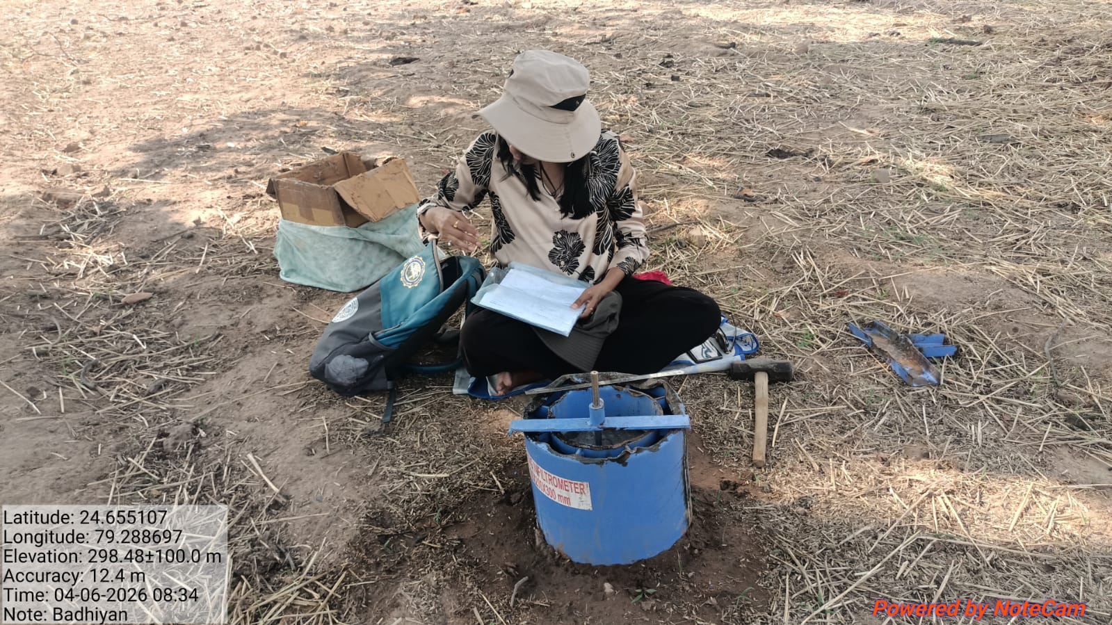
Smart Farming with Satellite and GIS Introduction Agriculture is the backbone of India’s economy, employing over half of the workforce and feedingmore …